Smart Tool Overview

Tool Name: Wx_By_Variable4

 
(Required) Input Grid(s):   
  • IFPS Grids:
    • Elements: PoP, QPF, RH, SnowLevel, T, Td, Topo, Wx
  • D2D Model Grids: MESO ETA, ETA, AVN , MRF
    • Elements: gh, cape, sli
Output Grid(s): 
  • IFPS Grids:
    • Elements: Wx

User Selectable Parameter(s):

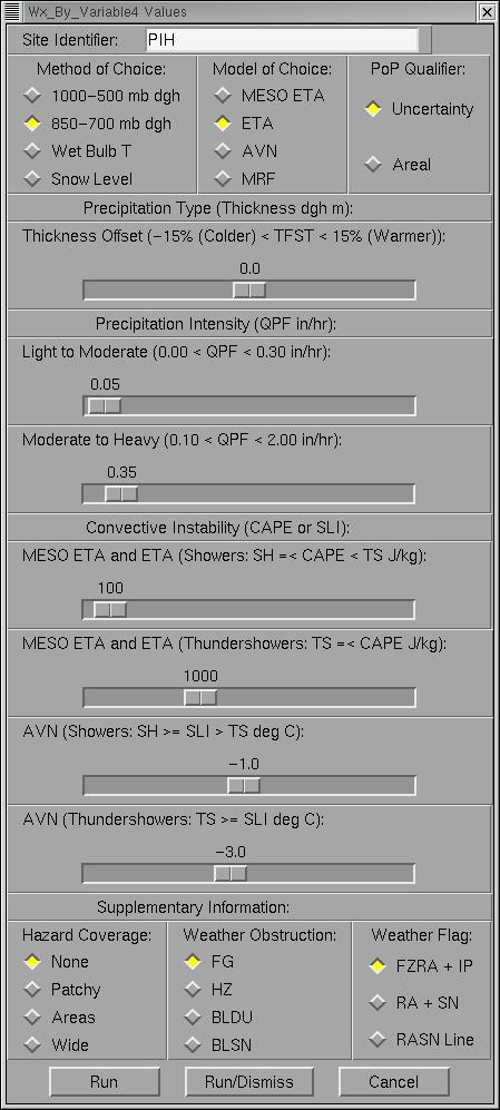
  • Site Identifier: XXX
  • Method of Choice:
    • 1000-500 mb (thickness) dgh
    • 850-700 mb (thickness) dgh
    • Wet Bulb Temperature 
    • Snow Level
  • Model of Choice: MESO ETA, ETA, AVN, MRF
  • PoP Qualifier: Uncertainty, Areal
  • Thickness Offset: (-15% < TFST < 15%)
  • Light to Moderate QPF: (0.00 in/hr < QPF < 0.30 in/hr)
  • Moderate to Heavy QPF: (0.10 in/hr < QPF < 2.00 in/hr)
  • META/ETA CAPE: Showers (J/kg)
  • META/ETA CAPE: Thundershowers (J/kg) 
  • AVN SLI: Showers (deg C)
  • AVN SLI: Thundershowers (deg C) 
  • Hazard Coverage: None, Patchy, Areas, Wide
  • Weather Obstruction: FG, HZ, BLDU, BLSN
  • Weather Flag:
    • FZRA + IP
    • RA + SN
    • RASN Line

User Selectable Default Value(s):

  • PIH
  • 850-700 mb dgh


  • ETA
  • Uncertainty
  • 0.0
  • 0.05
  • 0.35
  • 100
  • 1000
  • -1.0
  • -3.0
  • None
  • FG
  • FZRA + IP

Description:

Methods:

This smart tool calculates the Weather Grid using four methods:

[Note: The IFPS PoP, QPF, and Wx grids are used in all methods.]

(1) 1000 to 500 mb partial thickness

  • uses D2D gh model grids at 1000 mb and 500 mb levels
  • reference: 26th Operational Air Squadron : AFWA TN - 98/002, 1998

(2) 850 to 700 mb partial thickness

  • uses D2D gh model grids at 850 mb and 700 mb levels
  • reference: 26th Operational Air Squadron : AFWA TN - 98/002, 1998
  • reference: BUFKIT : Mahoney et al., 1998

(3) Wet Bulb Temperature

  • uses hydrostatic and Clausius-Clayperon equations
  • uses IFPS T, Td, and RH grids
  • reference: Jensen et al., 1990

(4) Snow Level

  • uses IFPS SnowLevel and Topo grids

Models:

The smart tool uses (D2D fields from) four NCEP models:

(1) MESO ETA (gh, cape); (2) ETA (gh, cape); (3) AVN (gh, sli); and (4) MRF (gh)

Other Variables:

The precipitation intensity is defined in NWS-OH #7 and is a function of the IFPS QPF Grid.

The precipitation uncertainty or areal qualifier is a function of the IFPS PoP Grid.

Convective instability is set as a function of D2D model (MESO ETA, ETA) Surface CAPE or (AVN) Surface Lifted Index.

The obstructions to vision (F, H, BD, BS) are calculated in regions where the PoP grid is (0% <= PoP < 11%).

Strengths:
  • features numerous user settings in GUI to control forecast precipitation type, precipitation coverage, precipitation intensity, weather obstruction, and convective instability
  • uses meteorologically sound partial thickness methods for predicting precipitation type
  • uses terrain based wet bulb temperature and snow level methods for predicting precipitation type
  • uses model instability to discern convective versus stratiform precipitation
  • allows user to screen out FZRA and IP in favor of a RA and SN mix or a simple RASN line
Weaknesses:
  • 850 to 700 mb thickness method may be insensitive to shallow or topographically distorted frontal features
  • 850 to 700 mb thickness method is not as accurate in the mountains versus valleys
  • relies heavily on IFPS or D2D model fields to run algorithms for various methods
  • Wx grids in Days 5, 6, and 7 may not have available model data to process smart tool


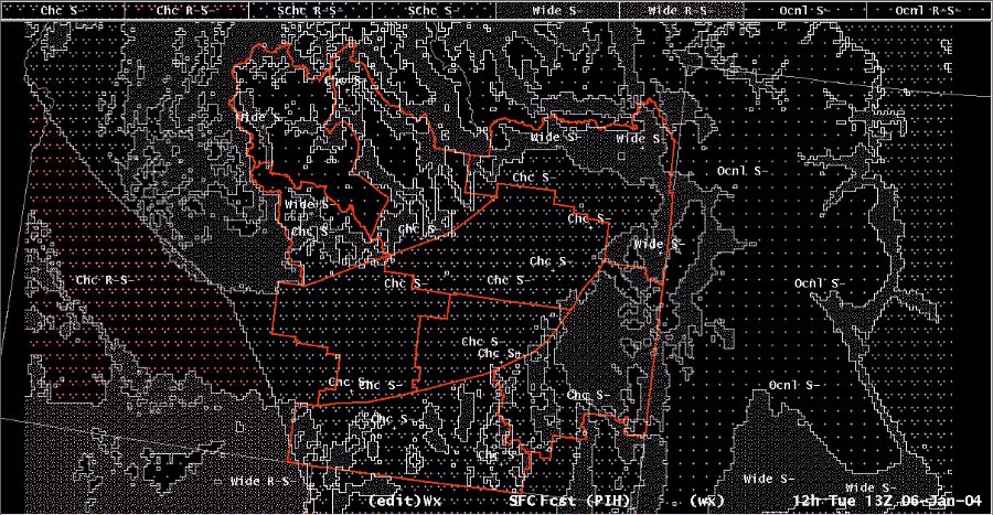
Example: January 6, 2004

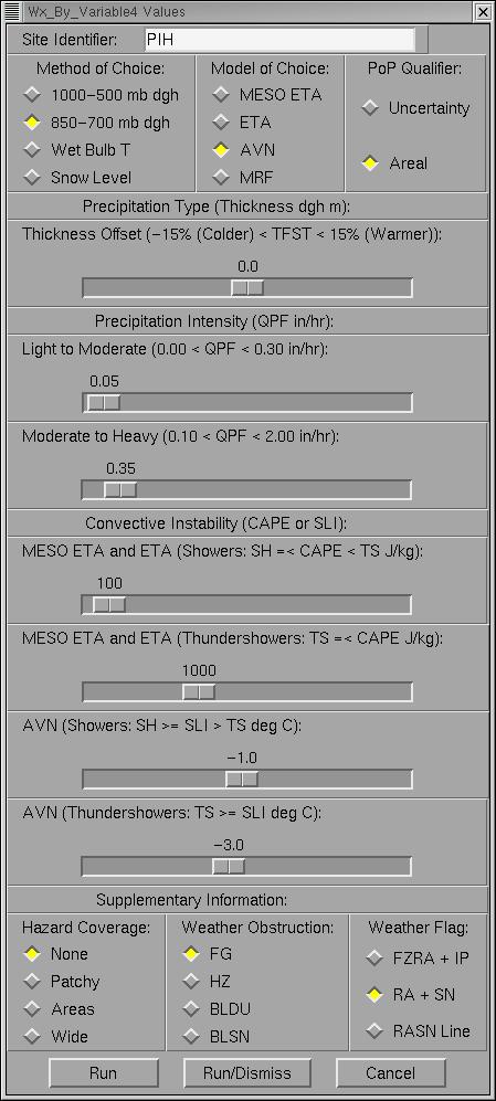
  • Figure 1
  • Figure 2

  • Figure 1
  • Figure 2
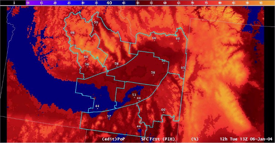
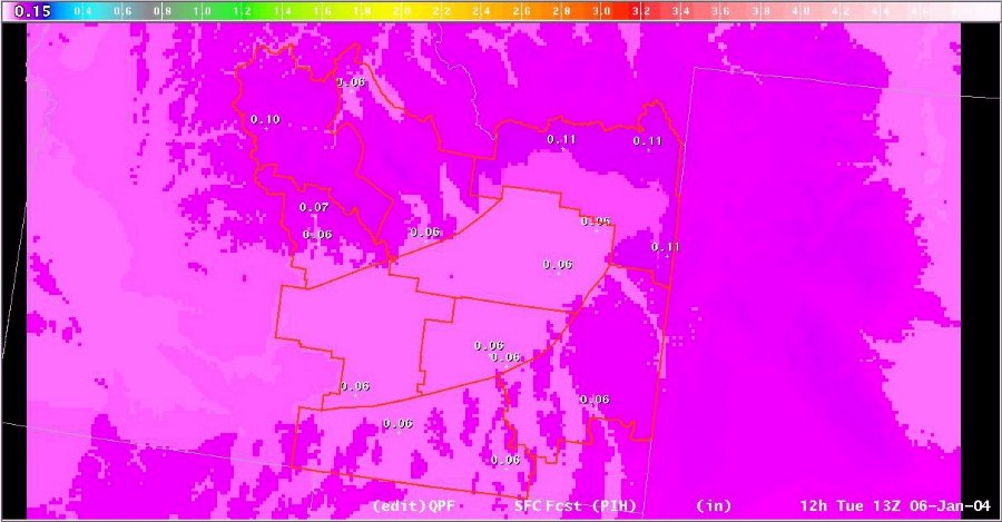
  • Figure 3